Google is reportedly working on adding a new layer in Google Maps that will provide users with important COVID-19 outbreak information.
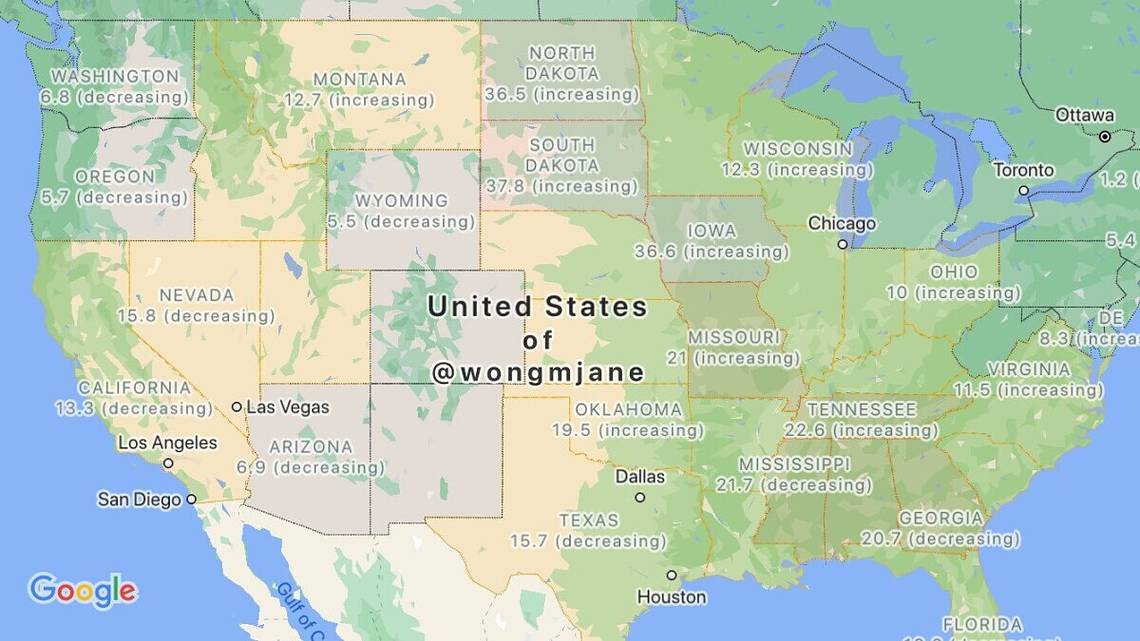
Jane Manchun Wong, who is famous for reverse engineering apps to uncover new features before they’re announced, posted images of the new layer on Twitter. The layer appears to show the number of COVID-19 outbreaks in a particular U.S. state and/or country. The data also whether cases are increasing or decreasing in the region.
Based on screenshots of the feature, Google is apparently sourcing its data from Wikipedia, The New York Times, Johns Hopkins University, and Brihanmumbai Municipal Corporation. When/if this COVID-19 layer goes live in Google Maps, users will be able to access it the same way they would traffic, transit, and Street View information. While the layer appears to be able to show data on a per-state basis, it’s unclear if you can drill down deeper into cities and counties.
The new layer is now yet accessible in the latest version of the Google Maps app, which is version 10.5.0. However, when it does go live, we'll update this article.
Google has brought a number of new features to Google Maps following the COVID-19 outbreak earlier this year. The service has displayed messages encouraging users to wear masks, along with highlighting safe hotel rooms for first responders. While you wait for the arrival of a COVID-19 layer in Google Maps, you can get more information about the virus on the CDC’s website for the U.S. or from the WHO.